

Adventure & Expedition Travel
Travel Beyond the Ordinary
Tour du Mont Blanc: The Mountain Three Countries Can’t Agree On

Co-Founder & Travel Advisor, Dorian Destinations · Published October 15, 2026 · ET
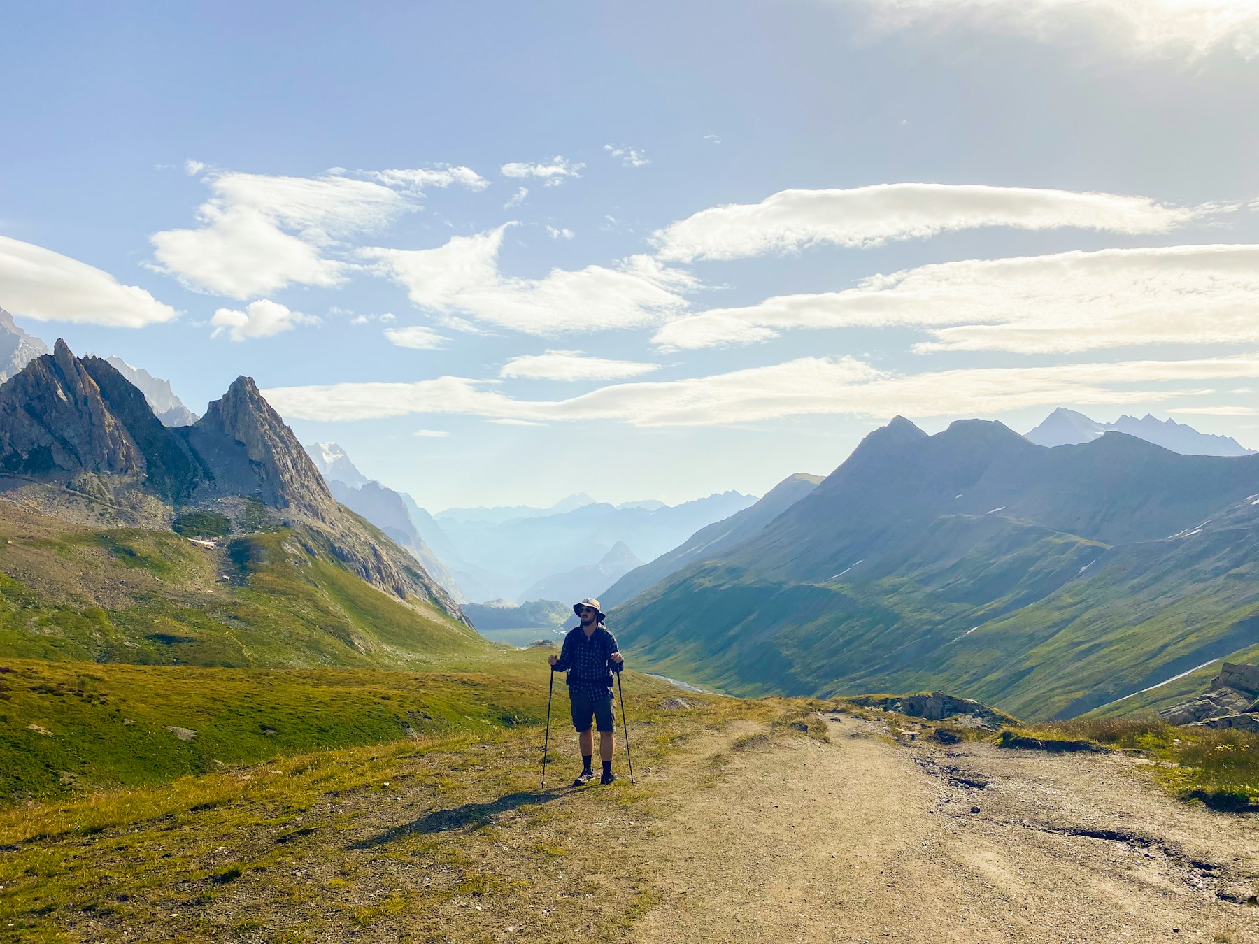
Plan a Tour du Mont Blanc around the huts, not the kilometres →
Three countries, one mountain, and no agreement at all about what it is. The Tour du Mont Blanc is the most walked long route in the Alps, and the massif it circles is not a World Heritage Site.
That is not an oversight, and it is not because nobody tried. France put the Massif du Mont Blanc on its UNESCO tentative list on 8 June 2000, as reference 1431, filed as a mixed property out of Haute-Savoie.
Italy filed its own version eight years later, on 30 January 2008, as reference 5265 — this one a purely natural transboundary nomination under all four natural criteria, naming Valle d’Aosta, Haute-Savoie and the Canton du Valais together. Switzerland, whose ground that third name describes, has never filed the mountain at all. Its entire tentative list today holds one item: a concrete bridge over the Salgina gorge, submitted in 2017.
So the walk goes round a mountain that two governments have described in two different languages of heritage, and a third has declined to describe at all. Twenty-six years into France’s file and eighteen into Italy’s, the Tour du Mont Blanc remains the best way to see what the paperwork is arguing about — and the argument turns out to be a surprisingly good way to organise the walk.
Every route number in this piece comes from Espace Mont-Blanc, the cross-border authority that publishes the official Tour du Mont Blanc itinerary and its trail notices. Every heritage fact comes from UNESCO’s World Heritage Centre, cited by reference number so you can read the files yourself.
The shape of the piece is ours. UNESCO publishes a dossier, not an itinerary; Espace Mont-Blanc publishes key points, not a pace. Where we say which stage to cut, which direction to walk or when to go, that is our judgment as travel advisors and it is labelled as judgment every time it appears.
And the limit is worth stating plainly. We are travel advisors, not a mountain guiding company. We hold no hut allocation anywhere on this circuit, we employ no guides on it, and we cannot get you a bed at Rifugio Bonatti in August that somebody else booked in January.
“The Mont Blanc massif … constitutes one of the mythic high places of alpinism, on the same footing as Everest or Annapurna.” — UNESCO World Heritage Centre, tentative list ref. 1431 (translated from the French original)
That is the file France lodged in 2000, and the comparison it reaches for is the one we wrote about three weeks ago on the Everest base camp trek. The difference is that Everest’s mountain sits inside an inscribed property and Mont Blanc’s does not.
What the Tour du Mont Blanc actually is, on paper
Espace Mont-Blanc gives the circuit as 170 km with 10,000 m of altitude gain, about 60 hours of walking, a maximum altitude of 2,600 m, and a difficulty rating of Difficult. It lists the duration as 240 hours, which is simply ten days of elapsed time — 60 hours of that is walking, so the honest daily figure is about six hours on foot and 17 km covered.
The ascent number is the one worth sitting with. Ten thousand metres of climbing is 1,152 m more than the height of Everest, which UNESCO records at 8,848 m in the Sagarmatha National Park file. You do it in stages, with a bed and a kitchen at the end of each, which is why the Tour du Mont Blanc reads as approachable and the arithmetic does not.
There is no single way to walk it. Espace Mont-Blanc names two directions, nine official starting points — Courmayeur, Les Houches, Chamonix, Les Contamines, St Gervais, Chapieux, Orsières, Champex and La Fouly among them, with Trient as well — a lift and bus network that can shorten almost any day, and a thicket of variants. What follows is the classic anticlockwise sequence from Les Houches, told in the seven blocks the authority itself uses, and read against the two nomination files the route walks through.
1. Les Houches to Les Contamines-Montjoie — the stage everybody rides over
Start with the one you are about to be sold out of. The opening block runs Les Houches – Col de Voza – Bionnassay – Champel – Tresse – Les Contamines-Montjoie, and a lift exists precisely so that you do not have to walk the first half of it. Most packaged versions of the Tour du Mont Blanc use it.
We think that is a mistake, for a structural reason rather than a romantic one. The Col de Voza is where you get your first proper look at the north face of the Aiguille de Bionnassay and the Aiguille du Goûter, and it is the only morning on the circuit where the mountain stands directly above you rather than across a valley. Skip it and the massif stays an abstraction until day three.
Best for: Tour du Mont Blanc walkers who want the mountain legible from the first hour rather than the first viewpoint.
Go when: you have the extra half-day — this is the stage of the Tour du Mont Blanc to protect, not the one to trade away.
2. Les Contamines to Refuge Elisabetta — the long French day and the border
The authority’s second block is the biggest single swallow on the route: Les Contamines – Notre-Dame-de-la-Gorge – Nant Borrant – La Balme – Col du Bonhomme – Col de la Croix du Bonhomme – Les Chapieux – La Ville des Glaciers – Mottets – Col de la Seigne – la Casermetta – Refuge Elisabetta. Most people split it. We would too, at Les Chapieux, and we would call that judgment rather than doctrine.
The Col de la Seigne is the frontier, and from it Espace Mont-Blanc lists a sightline that takes in the Pyramides Calcaires, Mont Blanc itself, the Aiguille du Peuterey, the Dent du Géant and the Grandes Jorasses in one turn of the head. Just below it on the Italian side sits the Casermetta, the Espace Mont-Blanc information point in a converted military building, open daily from 25 June to 13 September 2026 and taking more than 10,000 visitors a summer.
Best for: the one day of the Tour du Mont Blanc you will describe to people who did not come.
Go when: the forecast is clean — the Seigne gives nothing back in cloud, and our view is that it is worth losing a day to.
3. Refuge Elisabetta to Courmayeur — into Italy’s version of the file
Elisabetta – Lac Combal – Arp-Vieille – Lac Chécrouit – Col Chécrouit – Plan Chécrouit – Dolonne – Courmayeur. This is the descent into Valle d’Aosta, and it is also the first ground covered by Italy’s nomination rather than France’s.
The two files describe the same rock very differently. France’s ref 1431 is a mixed submission filed under the theme of cultural landscapes, which is a way of saying the mountain matters partly because of what people did on it. Italy’s ref 5265 is natural, claimed under criteria vii, viii, ix and x — scenery, geology, ecological process and biodiversity, the full set, with no cultural claim at all. From Chécrouit you can see the glaciers of Miage and Brenva that the Italian case rests on.
Best for: anyone walking the Tour du Mont Blanc who wants to understand why the nomination stalled.
Go when: late afternoon, if you can time it — the Brenva side lights last.
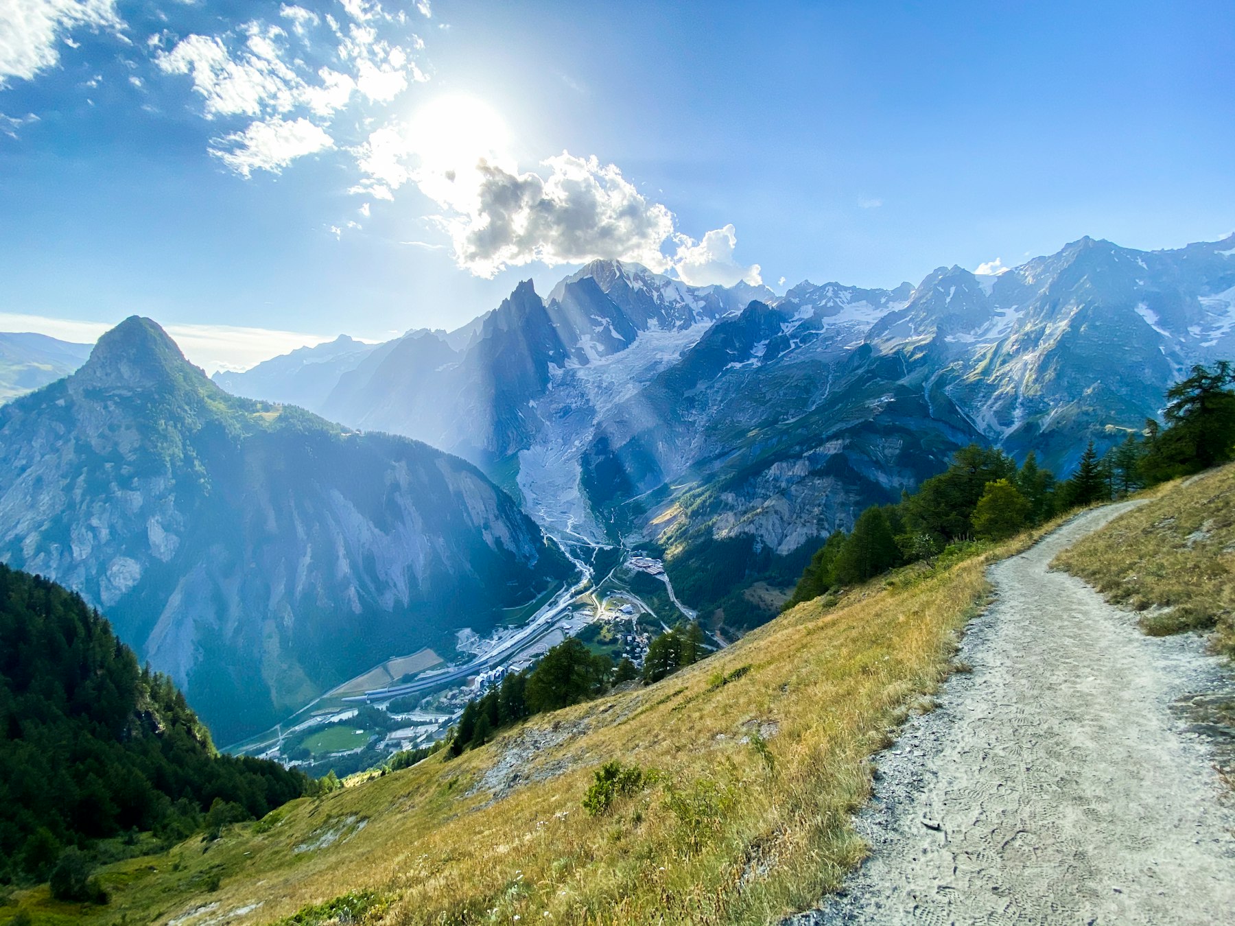
4. Courmayeur to Rifugio Bonatti — the balcony
Courmayeur – Villair – Rifugio Bertone – Rifugio Bonatti, with a higher variant over Tête Bernarda, Col Sapin, the Pas d’Entre-Deux-Sauts and Malatra. The main line is the one the photographs come from: a traverse the authority calls the balconata, with the Col de la Seigne behind you, the Aiguille Noire opposite and the Grandes Jorasses ahead.
It is also the shortest real day on the circuit, which makes it the one operators most often merge into its neighbours. Our judgment is that merging it is the worst edit you can make to a Tour du Mont Blanc itinerary: the balcony is the only stretch where you walk for hours with the whole south face in view and nothing else to do.
Best for: photographers, and anyone on the Tour du Mont Blanc who has been told the Italian side is the quiet one.
Go when: you can book Bonatti itself — it goes early, and the alternative is a long drop to the valley.
5. Where the Tour du Mont Blanc Crosses Into the Country That Never Filed
Bonatti – Arnouva – Refuge Elena – Grand Col Ferret – Chalet de la Peule, with a variant over the Petit Col Ferret to La Léchère. The Grand Col Ferret is the second frontier of the walk and, in our reading, the most interesting hour on the whole Tour du Mont Blanc.
Here is why. Italy’s 2008 submission is titled, in full, as an inscription of the Massif du Mont-Blanc as transboundary natural heritage with France and Switzerland, and its stated area covers the Canton du Valais explicitly. You walk into the Valais at this col. And Switzerland has never put the massif on its own tentative list — a state party cannot be entered into a transboundary nomination by its neighbours, so Italy’s file names a partner that has not signed up.
What Switzerland has inscribed, it inscribed elsewhere in the Alps. The Swiss Alps Jungfrau-Aletsch property went onto the World Heritage List in 2001, with a boundary modification in 2007, under criteria vii, viii and ix, covering 82,400 hectares. UNESCO describes it as the most glaciated part of the European Alps, containing Europe’s largest glacier, with the north wall centred on the Eiger, Mönch and Jungfrau. That is a serious property and nobody is suggesting otherwise. It is simply a hundred kilometres away from the mountain you are walking round.
From the col the authority lists the Grand Combin, Mont Dolent and the Aiguille de Triolet. Mont Dolent is the point where the three borders meet, which means that for a few minutes on this stage you can see the exact spot where three different legal opinions about one mountain intersect — two of them written down and one of them conspicuously absent.
We would give this stage a full day rather than running it into the next one, and we would say openly that the reason is argumentative rather than physical: the walking is not hard, and the point of the day is what you are standing on.
Best for: anyone who wants the Tour du Mont Blanc to be about something other than distance covered.
Go when: mid-season, when the Elena and Peule huts are both reliably open — our judgment, not a published schedule.
6. The Tour du Mont Blanc Swiss Sector, Rerouted This Year
La Peule – Ferret – La Léchère – La Fouly – Praz-de-Fort – Issert – Champex-Lac – Plan-de-l’Au – Bovine – Col de la Forclaz, with the Fenêtre d’Arpette as the high variant over the Trient glacier. This is the lowest, greenest, most pastoral part of the route, and it is the part most walkers remember least, which we think is the strongest argument for giving it more time rather than less.
It is also the stretch that changed in 2026. Espace Mont-Blanc has rerouted the path between Prayon and Branche, in the Treutsebo sector, because of rockfall risk. The new line has been open and signposted since Saturday 11 July 2026 and the old one is closed outright. Camping and bivouacking are prohibited in that area; the authority points walkers instead to the Glaciers campsite at La Fouly and the Rocailles and Relais d’Arpette sites. If your guidebook predates July, it is wrong here.
Best for: Tour du Mont Blanc walkers who want a day where the mountain is a backdrop rather than a wall.
Go when: you can check the Tour du Mont Blanc trail notices within a week of departure — this sector has now moved once.
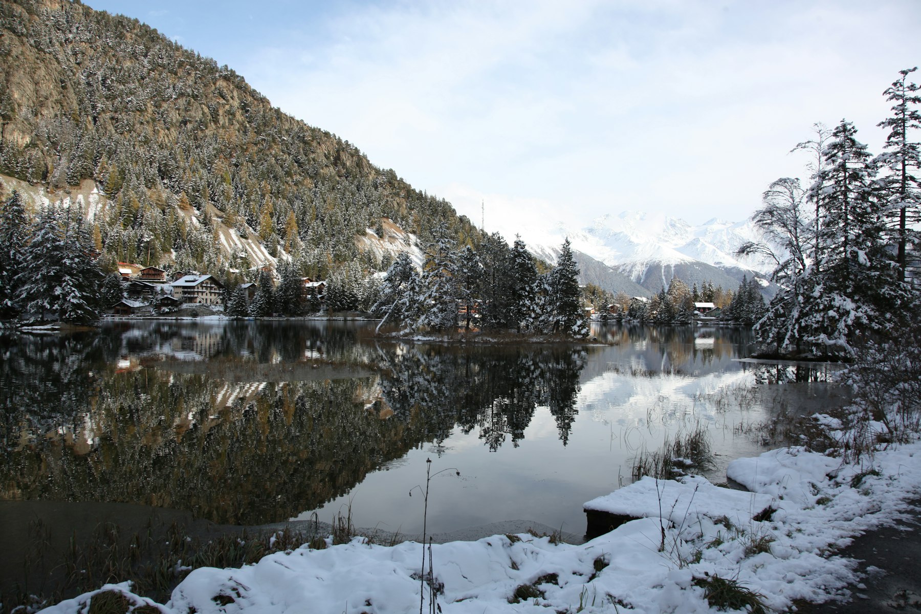
7. Col de la Forclaz to Les Houches — back into France, and into the crowds
Forclaz – Trient – Peuty – Col de la Balme – Col des Posettes – Tré-le-Champ – La Flégère – Col du Brévent – Les Houches, with variants through Vallorcine and over the Col des Montets. The Chamonix balcony delivers the circuit’s famous closing view — the Mer de Glace, the Aiguille Verte and the north wall of the Grandes Jorasses from Lac Blanc.
It is also the most heavily lift-served ground on the Tour du Mont Blanc, reachable in an afternoon by anyone staying in Chamonix. That is not a criticism of the scenery. It is the reason this is the stage we would cut if a trip is short, and we will come back to that in the verdict.
Best for: finishing the Tour du Mont Blanc on the view the posters use.
Go when: early in the day, before the Flégère and Brevent lifts fill the balcony.
MORE: This circuit is one of seven we ranked by what the register actually protects — see our guide to the world’s best trekking tours, where the Mont Blanc massif is the conspicuous absentee.
The Alps on UNESCO’s books, compared
| Record | Status | Filed / inscribed | What it covers |
|---|---|---|---|
| Massif du Mont Blanc (ref. 1431) | Tentative list, France | Submitted 8 June 2000 | Mixed; theme cultural landscapes; Haute-Savoie only |
| Massif du Mont-Blanc (ref. 5265) | Tentative list, Italy | Submitted 30 January 2008 | Natural; criteria vii, viii, ix, x; names Valle d’Aosta, Haute-Savoie and Valais |
| Swiss Alps Jungfrau-Aletsch (ref. 1037) | Inscribed | 2001, boundary change 2007 | 82,400 ha; criteria vii, viii, ix; Europe’s largest glacier |
| Prehistoric Pile Dwellings around the Alps (ref. 1363) | Inscribed | 2011 | 274.2 ha; 111 of 937 known sites across six countries, 5,000–500 BC |
All four rows are UNESCO’s own figures, read from the World Heritage Centre records. The grouping — two tentative files beside two inscribed properties — is ours, and is there to make one point: the Alpine property UNESCO has actually inscribed under the cultural criteria is 274.2 hectares of waterlogged archaeology, about three hundred times smaller than the Jungfrau-Aletsch property and nowhere near the mountain this walk circles.
Planning a Tour du Mont Blanc: the parts that actually bite
Beds first, everything else second
The circuit is not limited by your legs or by the 10,000 m of ascent. It is limited by a thin chain of refuges, and the popular ones — Bonatti, Elisabetta, Elena — are spoken for months ahead. Build the itinerary backwards from the nights you can actually get. Every Tour du Mont Blanc plan we have ever worked on has been reshaped by a hut, never by a map.
Direction, and why we still say anticlockwise
Espace Mont-Blanc publishes both directions and takes no position. Ours is that anticlockwise is better for a first circuit, because it puts the Col de la Seigne crossing early while you are fresh and leaves the Chamonix balcony for the end. That is a judgment about pacing, not a published recommendation, and plenty of experienced walkers go the other way.
Check the Swiss sector before you leave
The Prayon–Branche reroute is live and the old path is closed. Espace Mont-Blanc publishes trail conditions continuously, and this is the one part of the planning we would do in the week of departure rather than in the month of booking.
Two questions to ask any operator
Ask how many nights the itinerary spends on the Italian and Swiss sides versus the French one. Then ask what happens if a col is closed by weather on the day you are meant to cross it. The answer to the second question tells you more about the company than the first does.
Have us read the hut list before you pay a deposit →
Frequently Asked Questions
How long does the Tour du Mont Blanc take?
Espace Mont-Blanc gives the full circuit as 170 km over about ten days, with roughly 60 hours of actual walking. That works out at about six hours on foot and 17 km a day. Lifts and buses can shorten several stages, so shorter Tour du Mont Blanc itineraries are genuinely possible rather than merely marketed.
Is the Tour du Mont Blanc hard?
The authority rates it Difficult. The maximum altitude is only 2,600 m, so altitude is not the problem; the 10,000 m of cumulative ascent is. That is 1,152 m more climbing than the height of Everest, spread over ten days, which is why fitness matters here far more than technique.
Which direction should you walk the Tour du Mont Blanc?
Both are official. We recommend anticlockwise from Les Houches for a first circuit, so the Col de la Seigne comes early and the Chamonix balcony closes the loop. That is our judgment on pacing rather than a published rule, and the clockwise case is perfectly respectable.
When is the best time to walk the Tour du Mont Blanc?
The season follows the huts and the Italian information point at the Casermetta, which runs 25 June to 13 September in 2026. Our judgment is that the shoulders either side are quieter and visibly colder — snow at Champex-Lac is an ordinary sight outside high summer, not a freak event.
Is Mont Blanc a UNESCO World Heritage Site?
No. France listed the massif as tentative ref. 1431 in 2000 and Italy filed a separate transboundary version as ref. 5265 in 2008, but neither has been inscribed and Switzerland has never submitted it. The nearest inscribed Alpine mountain property is Swiss Alps Jungfrau-Aletsch, listed in 2001.
The Dorian Destinations Verdict
If you have nine days rather than eleven, do not buy the complete-circuit package. Cut stage one and stage seven — the two the lift network already shortcuts and the two closest to Chamonix — and put the saved nights into the Italian balcony and the Swiss sector instead.
We know what that costs us. The full Tour du Mont Blanc is the longer booking, the easier sale and the better margin, and nobody has ever rung us up annoyed that they completed the loop. The version we are recommending is shorter, cheaper and harder to describe at dinner, and it is the one that puts you on the ground the two nomination files are actually fighting over.
The register will probably catch up eventually. Until it does, the Tour du Mont Blanc is the rare walk where the paperwork is as interesting as the view — and the stretch nobody protects is the stretch we would give you an extra day on.
Talk to a Dorian Destinations advisor →
Sources: route distances, ascent, duration, difficulty, stage key points, starting points and the 2026 Prayon–Branche reroute and Casermetta opening dates from Espace Mont-Blanc. Heritage records from the UNESCO World Heritage Centre: Massif du Mont Blanc, tentative list ref. 1431 (France), Massif du Mont-Blanc, tentative list ref. 5265 (Italy), Switzerland’s tentative list, Swiss Alps Jungfrau-Aletsch, Prehistoric Pile Dwellings around the Alps and Sagarmatha National Park for the Everest elevation.
Adventure Travel · France · Italy · Switzerland · Europe