

Adventure & Expedition Travel
Travel Beyond the Ordinary
Everest Base Camp Trek: Book the Villages, Not the View

Co-Founder & Travel Advisor, Dorian Destinations · Published October 1, 2026 · ET
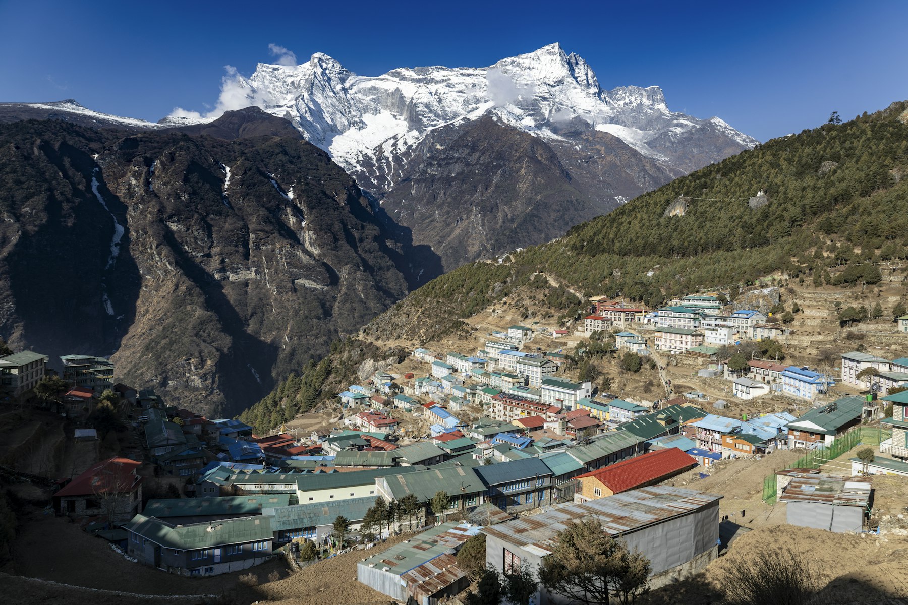
Plan an Everest base camp trek that starts at Monjo →
Almost nobody books an Everest base camp trek for the villages. They should.
The brochures sell an Everest base camp trek as a fortnight in the wilderness, and the photographs back them up: ice, rock, a tiny figure under an enormous face of snow. Then you land at Lukla and spend the next two weeks walking from one lived-in settlement to the next, past fields and stock and school buildings, with woodsmoke in the air most evenings. The mountain is there. It is just not what you are walking through.
Every fact below comes from UNESCO’s own World Heritage property records for Nepal — Sagarmatha National Park, the Kathmandu Valley, Chitwan and Lumbini. Boundaries, areas, inscription years, village and visitor counts and the wording about Sherpa settlement are quoted or paraphrased from those four records and nothing else. UNESCO’s descriptive text is published under CC-BY-SA IGO 3.0, so where we quote it we quote it in marks and say so.
The running order is ours. UNESCO publishes a boundary, not an itinerary, and it has no opinion about where you should sleep. Everything here framed as pacing, timing or where the walk is worth slowing down is our judgment as travel advisors and is labelled as judgment where it appears. What we are not: we are travel advisors, not a trekking outfitter. We hold no permits, we employ no guides or porters on this mountain, and we cannot get you a bed in Namche in October that somebody else booked in March.
“This park contains the world’s highest ecologically characteristic flora and fauna, intricately blended with the rich Sherpa culture.” — UNESCO, on Sagarmatha National Park
What an Everest base camp trek actually walks through
Sagarmatha National Park covers 124,400 hectares of the Solu-Khumbu district and takes in the upper catchment of the Dudh Kosi. It was gazetted in 1976 and inscribed in 1979, and the thing people forget is that it was never inscribed as empty ground. UNESCO’s record says the park “has combined nature and culture since its inception,” and it credits the people who live there with keeping it in one piece.
So the seven stages below run up the valley in the order you walk them, and each one is pegged to something the record actually says is there. Read them as a map of what you are passing rather than a schedule. Where we have put a view on timing, we have said so.
1. Lukla to Monjo: the stretch that is not in the park at all
You fly into Lukla, shoulder a bag and start walking, and for the first day and a half you are not inside the World Heritage property. UNESCO puts the southern boundary of Sagarmatha National Park at “physical divisions encompassing discrete physical entities in the Khumbu region with the southern boundary extending almost as far as Monjo on the Dudh Kosi River.” Almost as far as Monjo. Everything below that line — the airstrip, the first lodges, the lower river — is ordinary Nepali hill country, and it is lovely, and it is not the inscribed thing.
That matters less for bragging rights than for pacing. This is the stretch people rush because it does not feel like the Everest base camp trek has started.
Best for: getting your legs under you before an Everest base camp trek asks anything of you.
Go when: our judgment — late morning, after the Lukla flights have cleared, so you are not walking in a queue.
2. Monjo: where the World Heritage property actually begins
Monjo is where the register starts counting. From here up, you are inside 124,400 hectares that UNESCO describes as encompassing “the upper catchment of the Dudh Kosi River system,” with boundaries drawn deliberately so that the property holds together as one hydrological unit rather than as a scenic rectangle around a famous summit.
It is worth stopping at the gate long enough to read it, because the geography explains the walk. You are going up a single river system to its head. Every village, every ridge and every glacier above you drains through the point where you are standing. The Everest base camp trek is not a route across a mountain range; it is a walk up one catchment until the water runs out.
Best for: understanding why the days of an Everest base camp trek get harder in the exact order they do.
Go when: early, and with your permits already in hand rather than bought at the desk.
3. Namche Bazaar: the villages your Everest base camp trek sleeps in, and the line they sit outside
This is the part that changed how we sell the walk. UNESCO’s record states that the property “hosts over 20 villages with over 6000 Sherpas who have inhabited the region for the last four centuries.” Twenty villages. Four hundred years. That is not a scattering of huts in a wilderness park; that is a populated valley that happens to have the highest mountain on earth at the top of it.
Then comes the line almost nobody knows. The record says the Sherpas living within the park “carry out primarily agricultural or trade based activities and to ensure limited impact on the values and integrity of the property their properties have been excluded from the park by legal definition.” Read that again. The settlements are carved out. The inscribed World Heritage property is the ground between the villages, not the villages themselves.
So on an Everest base camp trek you cross in and out of a World Heritage site several times a day without noticing, and you sleep outside it almost every night. Which would be a pedantic footnote, except for what the same record says next: those communities’ traditional practices, including “the restriction of animal hunting and slaughtering, and reverence of all living beings,” have been “major contributing factors to the successful conservation” of the park.
The places legally excluded from the property are the reason the property survived. Namche is where you feel it: a working market town, not a basecamp.
Best for: anyone who has been told the Everest base camp trek is about solitude and would rather know the truth first.
Go when: our judgment — stay two nights, not one, and make the second one count for something other than acclimatisation.
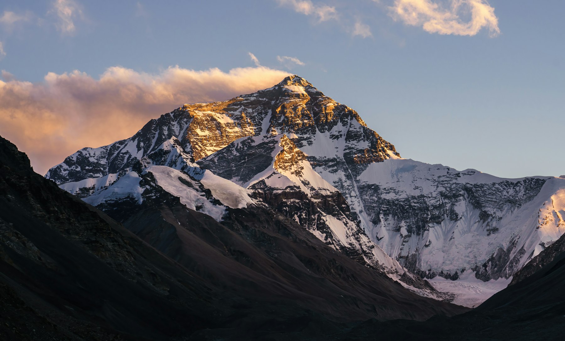
4. Above Namche: the seven peaks nobody counts
Ask most people what is in Sagarmatha National Park and you will get one answer, and it is 8,848 metres tall. The record is less romantic and more useful: the park is “an exceptional area with dramatic mountains, glaciers, deep valleys and seven peaks other than Mount Sagarmatha over 7,000 m.”
Seven. Not one. The skyline you walk under for a fortnight is a wall of them, and almost none gets named in the marketing because none of them is the famous one. This is the stretch of the Everest base camp trek where people start taking fewer photographs, having decided the view peaked at the first Everest sighting, and it is precisely where the valley gets grander.
Best for: Everest base camp trek walkers who want a horizon rather than a trophy.
Go when: our judgment — clear mornings beat clear afternoons up here, so start before the valley cloud builds.
5. The upper valley: six thousand metres of vertical in one park
Sagarmatha National Park holds “an elevation range of 6,000 m,” which is a strange and rather wonderful thing to put in a boundary description. One protected area, six kilometres of vertical. It is why an Everest base camp trek feels like it changes countries every two days: you are climbing through whole ecological bands, not just gaining height.
The record is blunt about what that produces — “the world’s highest ecologically characteristic flora and fauna” — and names the snow leopard and the red panda among the rare species living in it. You will almost certainly see neither. Knowing they are there changes the walk anyway, which is the honest case for reading a heritage listing before a packing list.
Best for: anyone who finds the scenery on an Everest base camp trek starts repeating itself on day six.
Go when: our judgment — the shoulder weeks either side of peak season, when the trail thins and the air is still clear.
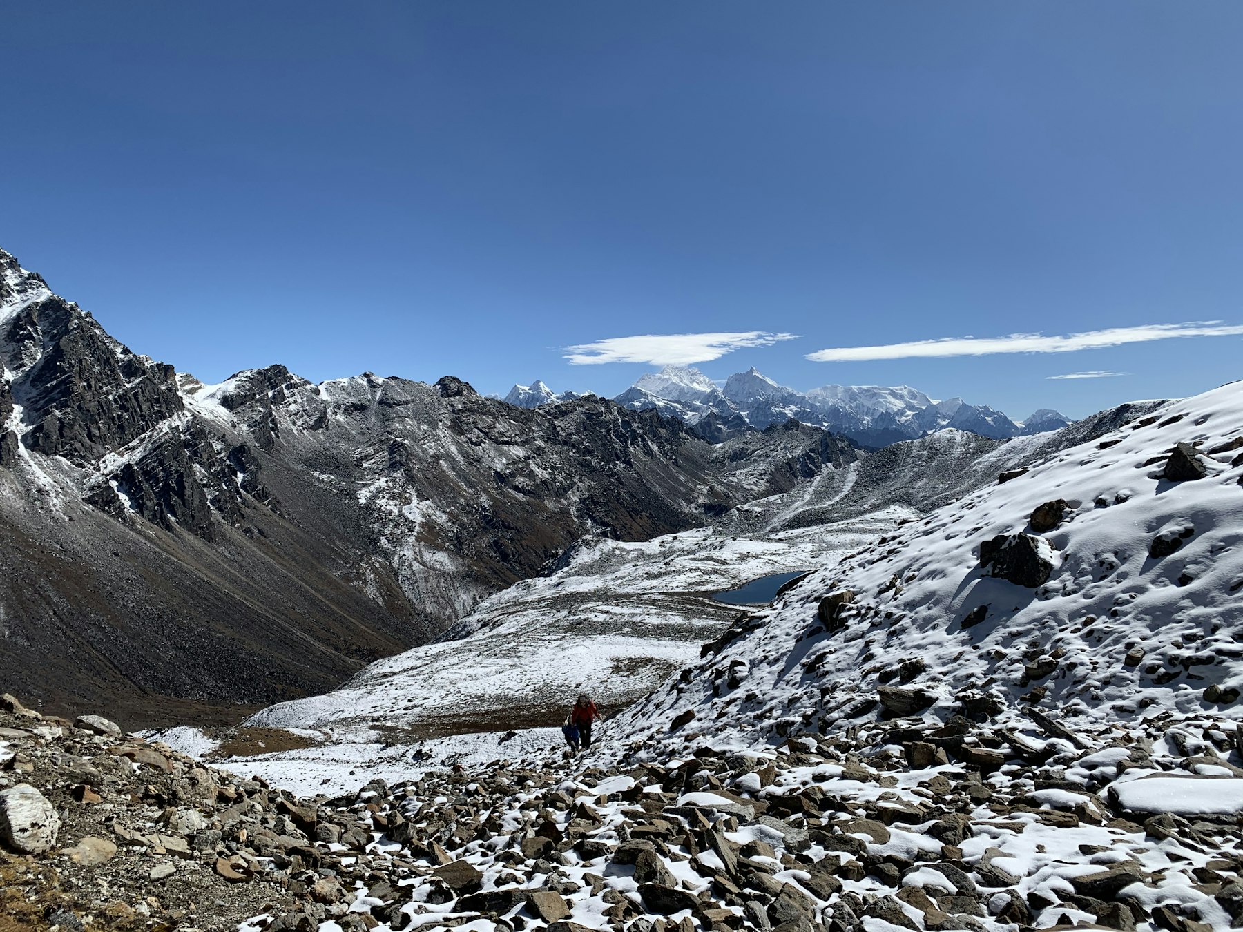
6. Base camp, and the border running along the ridge above it
Base camp itself is a moraine with tents on it, and everyone who gets there says the same slightly deflated thing about it. The interesting line is the one overhead. UNESCO defines the property’s northern boundary as “the main divide of the Great Himalayan Range, which follows the International boundary between Nepal and the Tibetan Autonomous Region of the People’s Republic of China.”
The skyline is a frontier. And the protection does not stop at it: the record notes that the park’s northern region is attached to the Qomolongma Nature Reserve on the Chinese side, with Makalu Barun National Park, established in 1998, to the east and the Gauri Shankar Conservation Area, from 2010, to the west. You are standing in the middle of a protected block far bigger than the park you paid to enter.
Best for: the long view on an Everest base camp trek, in every sense.
Go when: our judgment — give yourself a spare day here. Weather takes this one away from people more often than altitude does.
7. Down to the buffer zone: what 25,000 visitors did to the Everest base camp trek
On the way out you pass through the buffer zone, designated in 2002 and — this is the pattern of the whole walk — “not part of the inscribed property.” It exists as a protective layer, managed with local communities.
And here the record says something the travel industry rarely does. Visitor numbers went from “3,600 visitors in 1979 to over 25000 in 2010,” and UNESCO’s verdict on that is not a lament: it “has immensely boosted the local economy and standard of living with better health, education, and infrastructure facilities.” Park revenue is ploughed back into the communities by design. The crowds you may resent are part of why the place still works.
The park also flags what it is watching: it is “the major source of glaciers, providing freshwater-based benefits for the people downstream,” and it monitors climate change impacts on flora, fauna and Sherpa communities alike.
Best for: the walk out at the end of an Everest base camp trek, when most people have stopped looking.
Go when: our judgment — do not book the flight home for the day after you land in Kathmandu.
More from Dorian: Kilimanjaro Climb Tours: See All Seven Sites, Not Just One — the same argument, on a different continent and a very different mountain.
Nepal has four World Heritage properties. This walk reaches one.
Nepal is not a long list. The whole country holds four inscribed properties, and an Everest base camp trek takes you through exactly one of them — while the other three sit in places most trekkers transit through or skip entirely.
| Property | Inscribed | Area | Where it sits | On this trek? |
|---|---|---|---|---|
| Sagarmatha National Park | 1979 | 124,400 ha | Solu-Khumbu, eastern Nepal | Yes — from Monjo upward |
| Kathmandu Valley | 1979 | 167.37 ha | Kathmandu Valley | Only on your flight days |
| Chitwan National Park | 1984 | 93,200 ha | Southern central Terai | No |
| Lumbini, the Birthplace of the Lord Buddha | 1997 | 1.95 ha | Terai plains, southern Nepal | No |
Property names, inscription years and areas are taken from the UNESCO World Heritage property records; the right-hand column is our own reading, not UNESCO’s. Note the spread: Lumbini is inscribed at 1.95 hectares and Sagarmatha at 124,400, a factor of roughly sixty-four thousand. Read the area column as “what was inscribed,” not as how much there is to see.
Planning an Everest base camp trek: what we would actually book
Everything in this section is judgment rather than record. UNESCO describes a place; it does not tell you how to walk through it.
Build the itinerary around the settlements, not the kilometres
The compressed versions of an Everest base camp trek treat villages as waypoints between altitude gains. Turn that around. If twenty settlements and six thousand people are the reason the valley is intact, then the nights you spend in them are the trip, and the extra day in Namche is not padding.
Two questions worth asking any operator
Ask how many nights the itinerary spends below Monjo and above it — that tells you how much of the walk is actually inside the property. Then ask what happens if weather closes Lukla for two days on the way out. The answer to the second question tells you more about the company than the first.
Put the slack at the top, not the bottom
Spare days get spent early, when nothing has gone wrong yet. Our view: hold at least one in reserve for the upper valley, where weather, not fitness, is what usually takes the last stage away from people.
See how we build a Khumbu route →
Frequently Asked Questions
How many UNESCO World Heritage sites are in Nepal?
Four. Sagarmatha National Park and the Kathmandu Valley were both inscribed in 1979, Chitwan National Park followed in 1984 and Lumbini, the birthplace of the Lord Buddha, in 1997. It is a short national list for a country of Nepal’s cultural and physical range.
Is Everest base camp inside a World Heritage site?
Yes. Base camp sits within Sagarmatha National Park, inscribed in 1979 and covering 124,400 hectares. The ridge above it is the property’s northern boundary, which UNESCO defines as the main divide of the Great Himalayan Range and the international border with the Tibet Autonomous Region of China.
Are there villages on the Everest base camp trek?
Many. UNESCO’s record states the property hosts over twenty villages with more than 6,000 Sherpas who have lived in the region for four centuries. Those settlements have been excluded from the inscribed property by legal definition, so you sleep just outside the World Heritage site most nights.
When is the best time to do the Everest base camp trek?
This one is our judgment, not UNESCO’s — the heritage record says nothing about seasons. We favour the shoulder weeks at either end of the two main trekking windows: clear enough for the long views, quiet enough that the lodges in the villages are not full.
Is the Everest base camp trek crowded?
Busier than it was. The property record tracks visitors rising from 3,600 in 1979 to over 25,000 in 2010. UNESCO frames that positively, crediting it with improving local health, education and infrastructure through a revenue plough-back scheme, so the crowds are not purely a cost.
The Dorian Destinations Verdict
Do not book the compressed version of the Everest base camp trek. The ten- and eleven-day itineraries exist because they sell: they are cheaper, they fit a fortnight of annual leave, and nobody has ever rung me up annoyed that they did not get a second night in Namche. We make a better margin on them too. I am telling you to buy the longer one anyway.
Here is the reasoning, and it comes straight out of the register rather than out of my own romanticism. The thing UNESCO inscribed is a valley that twenty villages and six thousand people have kept intact for four centuries, and the organisation says so in as many words. The summit is the headline. The inhabited ground underneath it is the heritage. A schedule that treats Namche as an acclimatisation stop and the Sherpa settlements as scenery between altitude gains has bought the postcard and skipped the place.
And if standing on the moraine is genuinely the only part you want, say so and we will tell you honestly that there are better uses of two weeks and a long-haul flight. That is the same thing we said about walking in Patagonia: the famous photograph is rarely the best day of the trip.
Talk to a Dorian travel advisor →
Sources: UNESCO World Heritage Centre property records for Sagarmatha National Park, the Kathmandu Valley, Chitwan National Park and Lumbini, the Birthplace of the Lord Buddha, all read 1 October 2026. UNESCO descriptive text is published under CC-BY-SA IGO 3.0 and is quoted here, not reproduced. Photography via Unsplash, credited above.
Adventure Travel · Nepal · Asia · National Parks