

Adventure & Expedition Travel
Travel Beyond the Ordinary
Hiking Patagonia: The Seven Trails That Earn the Long Flight

Co-Founder & Travel Advisor, Dorian Destinations · Published September 17, 2026 · ET
Plan your Patagonia trek with us
Almost everyone who calls us about hiking Patagonia has already picked the trail. They just don’t know it yet.
The W in Torres del Paine has become shorthand for the whole region, which is a bit like saying you’ve seen Italy because you queued for the Colosseum. It is a genuinely superb route. It is also the single most booked walk in southern South America, and there are at least six other trails down there that give you more for the same flight. What follows is the seven routes we actually put clients on when they ask about hiking Patagonia, why each one exists, and the honest case for skipping the famous one.
Everything factual here comes from sources we read rather than remembered. Park boundaries, protected-area status and the landscape descriptions come from the UNESCO World Heritage Centre. Route distances, durations, park areas and visitor numbers come from the published record on each park. Where we are calling a season, a difficulty or a crowd level, we say so as judgment.
And the limit worth stating plainly: we are not a trekking outfitter and we hold no guide or refugio allocation, so we book you with operators and lodges on the same terms anyone else gets, and our value when you are hiking Patagonia is in choosing the route and the timing, not in conjuring a bed that isn’t there.
Los Glaciares National Park is embedded into the enchanted and remote mountain landscape of the Patagonian Andes shared by Argentina and Chile. — UNESCO World Heritage Centre
Why Hiking Patagonia Rewards the Stubborn
Here is the fact that reframes the whole region. Chile has seven properties on the UNESCO World Heritage List and not one of them is in Patagonia. Argentina has twelve, and three of those sit squarely in it: Los Glaciares, Los Alerces and the Cueva de las Manos rock-art canyon on the Rio Pinturas.
So the most photographed mountains in Patagonia are Chilean and unlisted, while the landscapes that carry the world’s highest formal recognition are Argentine and comparatively empty. That is not a knock on Chile. It is a map of where the hiking Patagonia crowds aren’t.
The other thing nobody tells you is that hiking Patagonia is a weather lottery with very long odds on any single day. Fitz Roy hides for a week at a time. The wind on the Paine massif can stop a fit adult walking. Any hiking Patagonia itinerary that hangs everything on one summit view is badly built, and the routes below are chosen partly because they still work on a grey day.
1. The W, Torres del Paine — The One Everyone Books
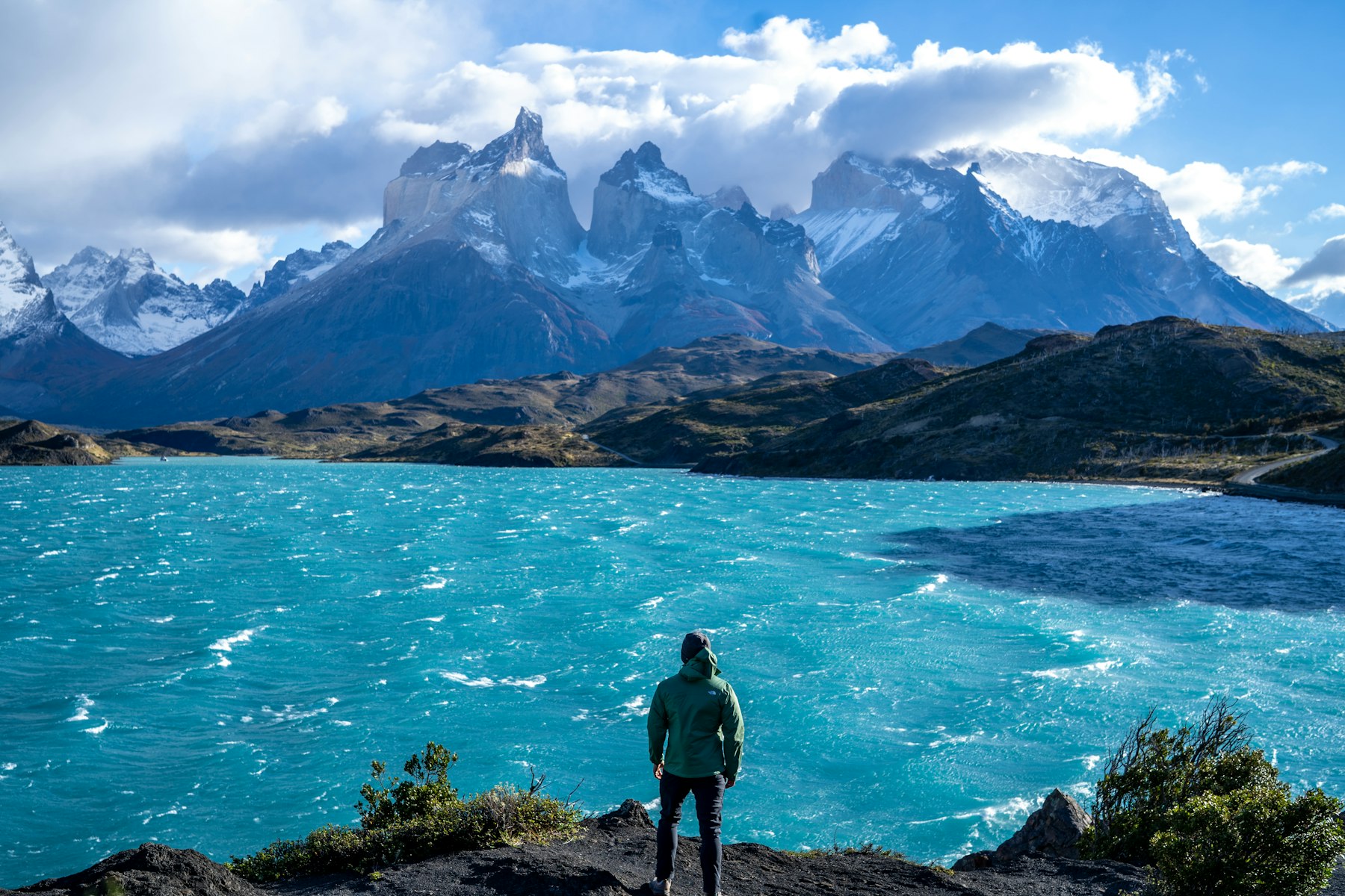
Fifty miles, three to five days, and a finish beneath the granite towers that put this park on every poster. Torres del Paine covers 181,414 hectares in Chile’s Magallanes region, 112 kilometres north of Puerto Natales, and took 304,947 visitors in 2019. The route strings together the Ascencio valley, the French valley and Grey Glacier, sleeping in refugios rather than tents if you want.
It deserves its reputation as the default hiking Patagonia route. It also means booking a campsite or refugio before you enter the park, which has been mandatory since October 2016, and accepting that you will share the Base Torres climb with a great many people at sunrise.
Best for: first-timers hiking Patagonia for the iconic view and a bed every night.
Go when: November to early December, or the second half of March. Our judgment, not an official window — January and February are the busiest and the windiest.
2. The O Circuit, Torres del Paine — The Better Version of the Same Park
Eighty-one miles, seven to nine days, and it contains the entire W as its southern half. The difference is the back side: the John Garner pass and the long descent above Grey Glacier, walked counter-clockwise and with a fraction of the foot traffic the front side carries.
This is the hiking Patagonia upgrade we push hardest when someone has the days. Same flights, same park fee, same trailhead, roughly double the walking and a completely different experience of the place. Camping is only permitted at designated sites, stoves only at refugios, and no wood fires anywhere in the park.
Best for: fit walkers with nine free days who want the famous park without the famous queue.
Go when: December to February for the most reliable pass conditions. Judgment call — the back section closes to hikers outside the main season.
3. Laguna de los Tres, El Chalten — The Day Hike That Beats Most Treks
El Chalten is a village of around three thousand people on the Rio de las Vueltas, 220 kilometres north of El Calafate, sitting inside Los Glaciares National Park at the edge of the Southern Patagonian Ice Field. Argentina calls it the Capital Nacional del Trekking, and unusually the title is earned: the trailheads start at the end of the street.
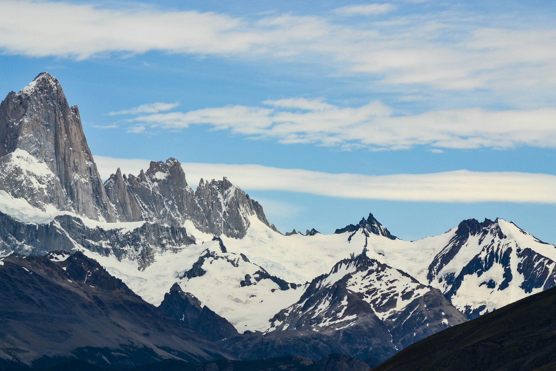
Laguna de los Tres puts you under Monte Fitz Roy, 3,405 metres of granite first climbed in 1952 by Lionel Terray and Guido Magnone. You walk out in the morning and sleep in a hotel that night. For a lot of people, that is the whole argument for hiking Patagonia from a town rather than from a tent.
Best for: travellers who want serious mountain scenery without committing to multi-day camping.
Go when: late October to April. Judgment — go early in your stay so you have spare days to re-try if the peak is clouded in.
4. Laguna Torre, El Chalten — The Wind Test
The companion walk, out to the glacial lake below Cerro Torre, and the one we send people on first when they are new to hiking Patagonia. It is gentler underfoot than the Fitz Roy route and it tells you honestly what Patagonian wind feels like before you commit to anything harder.
The name Chalten is a Tehuelche word meaning smoking mountain, which is what the peak does with cloud most days. In 1877 the Argentine explorer Francisco Moreno renamed it for Robert FitzRoy, captain on the second voyage of HMS Beagle. The old name is the more accurate description.
Best for: a first full day in the area, and for anyone travelling with mixed fitness in the group.
Go when: any settled morning in the season. Judgment — we treat it as the shakedown walk, not a highlight to save for last.
5. Cerro Castillo, Aysen — The Carretera Austral Sleeper
Seventeen hundred and ninety-five square kilometres in Chile’s Aysen region, south of Coyhaique, with the Carretera Austral running straight through it. Cerro Castillo was a national reserve from 1970 and became a national park in 2018, under an agreement between the Chilean government and Tompkins Conservation.
What you get is a basalt-toothed massif that looks like Torres del Paine’s wilder cousin, plus a real chance of seeing the endangered South Andean deer, guanacos, Andean condors and Magellanic woodpeckers. Lenga and nirre dominate the forest. Almost nobody hiking Patagonia for the first time has heard of it.
Best for: second-time visitors, and anyone combining a trek with a road trip down the Carretera Austral.
Go when: December to March. Judgment — the access road and the weather both get unreliable at the shoulders.
6. Dientes de Navarino — The Southernmost Circuit on Earth
Navarino Island, Chile, just south of Puerto Williams on the Beagle Channel. The Dientes are a 30-kilometre north-south range of jagged pinnacles topped by Pico Navarino at 1,195 metres, and the rough circuit around them takes five to seven days depending on what the weather does to you.
The route was first set out in the 1990s by the Australian climber and author Clem Lindenmayer, and two of the peaks it passes, Cerro Clem and Montes Lindenmayer, carry his name. There are no refugios, the trail is unmaintained in places and navigation is genuinely part of the challenge. This is the most serious hiking Patagonia route on this list.
Best for: experienced, self-sufficient trekkers who have already done the obvious routes.
Go when: December to February only. Judgment, and a firm one — go with a guide unless your navigation is properly current.
7. Los Alerces — The World Heritage Forest Nobody Walks
This is the one we would send a repeat client to tomorrow. Los Alerces sits in the Andes of northern Patagonia, its western boundary running along the Chilean border, covering 188,379 hectares with a buffer zone of another 207,313. UNESCO inscribed it for a landscape of moraines, glacial cirques, hanging valleys, chained lagoons and clear-water lakes.
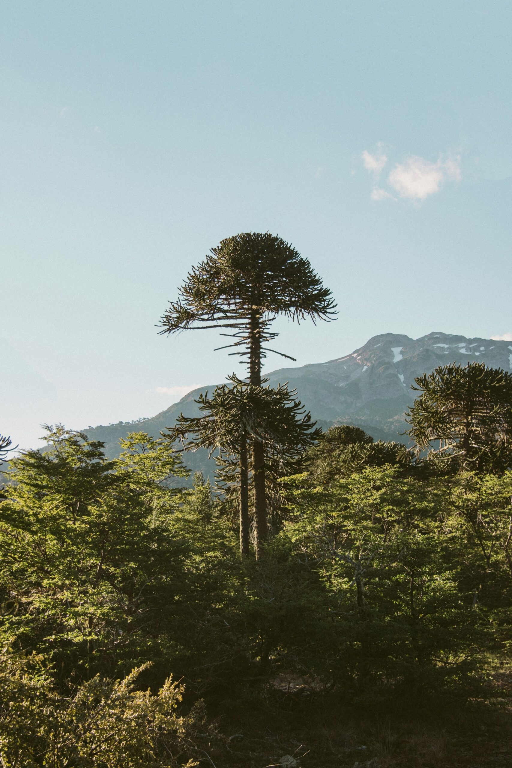
The reason it matters is the forest. Patagonian Forest is one of only five temperate forest types on the planet and the only temperate-forest ecoregion in Latin America and the Caribbean, and this park protects some of the last continuous stretches of it in near-pristine condition, including the longest-living population of alerce trees. Hiking Patagonia here is quiet, green and almost entirely unphotographed.
Best for: anyone who has done the granite and wants the other Patagonia.
Go when: December to March, with February the most settled. Judgment call — this is a wetter corner of the region than the south.
More from Dorian Destinations
Expedition travel packing list: the gear that actually matters in remote places
Hiking Patagonia: The Seven Trails Side by Side
| Trail | Country | Length / duration | Protected status | Crowd level |
|---|---|---|---|---|
| The W, Torres del Paine | Chile | 50 miles, 3–5 days | National park, 181,414 ha | Highest |
| The O Circuit, Torres del Paine | Chile | 81 miles, 7–9 days | National park, 181,414 ha | Moderate on the back half |
| Laguna de los Tres | Argentina | Day hike from El Chalten | Los Glaciares, World Heritage | High in season |
| Laguna Torre | Argentina | Day hike from El Chalten | Los Glaciares, World Heritage | Moderate |
| Cerro Castillo | Chile | Multi-day, Aysen region | National park since 2018, 1,795.5 km² | Low |
| Dientes de Navarino | Chile | 5–7 days, 30 km range | Navarino Island, Magallanes | Very low |
| Los Alerces | Argentina | Multi-day, northern Patagonia | World Heritage, 188,379 ha | Very low |
Areas, durations and protected status as published by UNESCO and the parks themselves. Crowd levels are our own assessment and shift sharply with the month you travel.
How We Actually Build a Hiking Patagonia Trip
Book the beds before you book the flights
Refugio and campsite reservation inside Torres del Paine has been compulsory since October 2016, and the good nights go first. We work backwards from bed availability, not from a wishlist of dates. If the beds aren’t there, the itinerary changes, not the standard.
Build in spare days on purpose
Two of them, minimum, on any trip built around a named summit. Fitz Roy and Cerro Torre are both routinely invisible for days. A spare day is not slack in the schedule, it is the difference between seeing the mountain and not.
Cross the border deliberately, not accidentally
Torres del Paine is Chilean and El Chalten is Argentine, and people routinely underestimate what sits between them. Combining the two is the right call for most first trips, but it wants a planned overland day rather than an optimistic morning.
Match the trail to the walker, honestly
This is where most self-planned hiking Patagonia trips come apart. Somebody books the O circuit on the strength of a few weekend hikes at home, then spends nine days suffering. We would rather put you on four superb day walks you enjoy than one long one you endure.
Get a route matched to your fitness
Frequently Asked Questions
What is the best time of year for hiking Patagonia?
The southern summer, roughly November through March, is the only reliable window for the high routes. Our own preference is late November or the second half of March, which trade a little weather risk for markedly fewer people on the trail. January and February are the busiest and, in our experience, the windiest.
How many days do you need in Patagonia?
Ten to fourteen on the ground is the honest minimum for a hiking Patagonia trip that includes both Torres del Paine and El Chalten, because the overland transfer between them eats the better part of two days. Under a week, pick one side of the border and walk it properly rather than racing between both.
Is the W trek hard?
It is long rather than technical. Fifty miles over three to five days on well-marked paths, with refugios if you would rather not carry a tent. The difficulty most people hiking Patagonia underestimate is the wind and the consecutive days, not the gradient or the terrain itself.
Do you need a guide for hiking Patagonia?
Not for the W, the O circuit or the El Chalten day walks, which are marked and busy enough to self-guide. Certain parts of Torres del Paine do require a certified guide, and we would not send anyone onto the Dientes de Navarino circuit unguided unless their navigation is genuinely current.
Which is better, Torres del Paine or El Chalten?
El Chalten, for most people, and it is not especially close. The trailheads start in the village, you sleep in a hotel, the mountains are every bit as dramatic, and it costs less. Torres del Paine wins if what you specifically want is a multi-day hut-to-hut circuit.
Is Torres del Paine a UNESCO World Heritage Site?
No. Chile has seven properties on the World Heritage List and none of them is in Patagonia. The Patagonian World Heritage sites are Argentine: Los Glaciares, Los Alerces and the Cueva de las Manos rock art on the Rio Pinturas, painted between 9,300 and 1,300 years ago.
The Dorian Destinations Verdict
If you have one trip and ten days, skip the W and base yourself in El Chalten. You will walk under Fitz Roy and Cerro Torre, sleep in a bed, eat properly, spend less, and stand inside a World Heritage landscape rather than beside one. That advice costs us the more expensive booking, and we give it anyway because it is the hiking Patagonia trip people come home happy from.
Book the W only if the multi-day hut-to-hut format is the thing you actually want from hiking Patagonia. If it is, take the nine days and walk the O circuit instead, because the back half is the part of that park worth flying for.
And if you have already done the granite, go to Los Alerces. One of five temperate forest types on Earth, protected in near-pristine condition, and almost nobody walks it. That is the version of hiking Patagonia we find ourselves envying.
Talk to a Dorian travel advisor
Sources: UNESCO World Heritage Centre, Los Glaciares National Park; UNESCO World Heritage Centre, Los Alerces National Park; UNESCO World Heritage Centre, Cueva de las Manos; UNESCO World Heritage Centre, Chile; UNESCO World Heritage Centre, Argentina; published park records for Torres del Paine, Cerro Castillo, Monte Fitz Roy, El Chalten and the Dientes de Navarino.
Adventure Travel · Chile · Argentina · National Parks