

Beyond the Obvious
Discover More
Hadrian’s Wall: Follow Rome’s Frontier Across Six Countries

Co-Founder & Travel Advisor, Dorian Destinations · Published October 14, 2026 · ET
Plan a Hadrian’s Wall trip that does not stop at Hadrian’s Wall →
Most people see Hadrian’s Wall the way they see a cathedral. You go to the famous bit, you take the photograph, you drive home. It works. It is also a very small fraction of the thing you came to look at.
The World Heritage List does not record Hadrian’s Wall as a monument in its own right. It records it as one section of an entry called Frontiers of the Roman Empire, and over the last forty years that entry has quietly become four separate inscriptions spread across six countries. Walk the whole of the inscribed line and you would cross northern England, central Scotland, the German uplands, the Dutch river delta, the Austrian Danube, a corner of Slovakia and most of Romania. Hardly anybody does it. Hardly anybody knows it is there to be done.
Every figure in this piece comes from UNESCO’s own property records on the World Heritage List: the Frontiers of the Roman Empire entry that contains Hadrian’s Wall, the Lower German Limes, the Danube Limes (Western Segment) and Dacia, plus the separate record for the Dacian Fortresses of the Orastie Mountains. Lengths, inscription years and inscribed areas are quoted from those records and nowhere else. Where we add two of their numbers together we say so in the sentence.
The order of the seven stops below is ours, and it is judgment rather than record. UNESCO publishes boundaries, criteria and hectares; it does not publish a route, a season or an opinion about which end to start at. Everything in the Go when: lines is our seasonal judgment from building trips in these countries, and we have labelled it as judgment every time it appears rather than letting it borrow the authority of the citation above it.
What we cannot do is also worth saying. We are travel advisors, not archaeologists and not a licensed guiding company on any of these sites. We hold no excavation access, we cannot get you behind a fence at a working dig, and we will not tell you a reconstructed building is an original one because it photographs better.
The Roman Empire … was protected by a network of frontiers stretching from the Atlantic Coast in the west to the Black Sea in the east, from central Scotland in the north to the northern fringes of the Sahara Desert in the south. — UNESCO, Frontiers of the Roman Empire property record
What the Register Records When You Look Up Hadrian’s Wall
Look up Hadrian’s Wall on the World Heritage List and you do not find it. You find a property called Frontiers of the Roman Empire, inscribed in 1987, whose boundaries were significantly modified twice afterwards, in 2005 and again in 2008. That property holds three sections: Hadrian’s Wall itself, the Upper German-Raetian Limes and the Antonine Wall.
Three more inscriptions have since joined the family. The Lower German Limes and the Danube Limes, Western Segment both arrived in 2021. Dacia followed in 2024, and the Danube entry has had minor boundary work recorded as recently as this year.
Add UNESCO’s own stated lengths for all six sections and you get a little under 2,800 kilometres. That is our arithmetic on their figures, not a number they publish. Hadrian’s Wall accounts for 130 of them, which is under one twentieth of the line. The four inscriptions together protect roughly 3,653 hectares between them, because a frontier is a very long and very thin thing to draw a boundary around.
1. Hadrian’s Wall, Northumberland — the Famous Forty-Five Kilometres
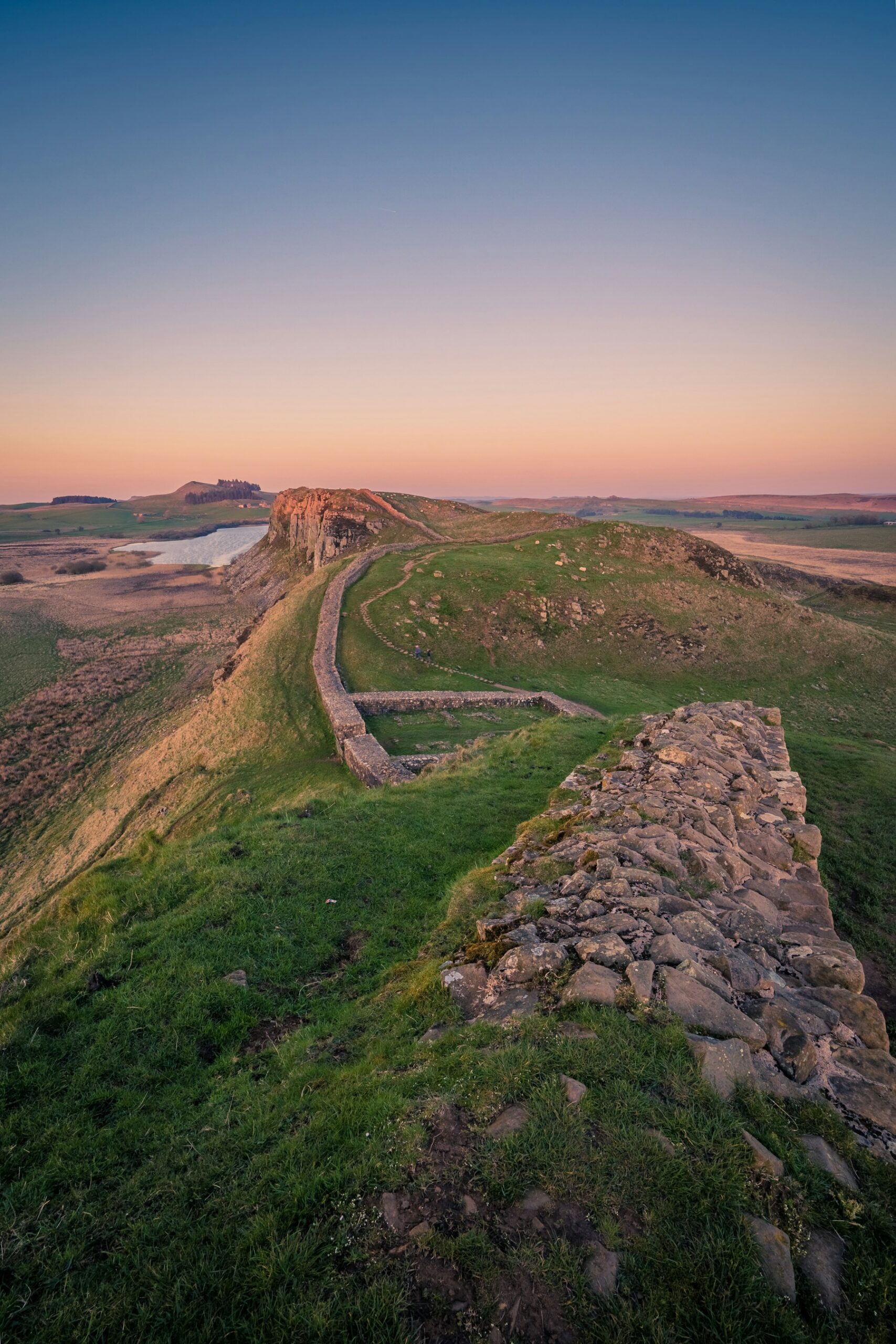
Start here, because everyone does and because it genuinely is the best-preserved stretch. UNESCO records Hadrian’s Wall running 130 kilometres from the mouth of the Tyne to the Solway Firth, built on Hadrian’s orders in AD 122, with a further 36 kilometres of intervisible installations continuing down the Solway coast. The record also says about four fifths of the line runs through open country, and that within the central 45 kilometres the remains survive in an exceptionally good state.
That sentence is why the crowds are where they are. It is also the honest reason to keep going: the central 45 kilometres are the exception, not the rule, and the rest of the frontier asks you to read a landscape rather than photograph a wall.
Best for: the one section that looks like the thing in your head.
Go when: late May to early July, on our judgment — long light, firm ground underfoot and the ridge walk open before the August coach traffic.
2. The Antonine Wall, Central Scotland — Hadrian’s Wall’s Short-Lived Successor
Twenty years after Hadrian, the emperor Antoninus Pius pushed the border north. UNESCO records the Antonine Wall as an attempt in the 140s AD to conquer parts of northern Britain, running some 60 kilometres across central Scotland from the Forth to the Clyde. The 1987 property records significant boundary modifications in 2005 and 2008, and the Antonine Wall is one of the three sections it now contains.
What makes it a different day out is the preservation. The record splits it into thirds: about one third is visible today as earthworks and associated structures, roughly another third lies in open countryside with its line invisible, and the final third sits under urban areas. You spend the day being shown where something was, by people who are very good at it, rather than looking at it.
Best for: travellers who have already walked Hadrian’s Wall and want the sequel.
Go when: June to September, on our judgment — the earthworks read far better when the grass is short and the light is low.
3. The Upper German-Raetian Limes — 550 Kilometres of Straight Line
This is the stretch that changes how you think about the whole project. UNESCO records the Upper German-Raetian Limes covering 550 kilometres between Rheinbrohl on the Rhine and Eining on the Danube, built in stages during the second century. There is no sea at either end. It is a line drawn overland between two rivers.
The property record is unusually blunt about how it was drawn. In large parts, it says, the frontier was an arbitrary straight line that took no account of the topography, and is therefore an excellent demonstration of Roman precision in surveying. About half of its length is still visible, or still identical with a modern border or right of way — which is the quiet detail that makes a German field boundary worth stopping the car for.
Best for: anyone who finds surveying more impressive than the masonry at Hadrian’s Wall.
Go when: May to October, on our judgment — the reconstructed forts and their museums keep short winter hours.

4. The Lower German Limes — Where the Conquest Stopped
Inscribed in 2021, the Lower German Limes ran 400 kilometres down the Lower Rhine, from the Rhenish Massif south of Bonn to the North Sea coast in the Netherlands, and held for more than 450 years from the late first century BC. The record contains the best single sentence in the whole family: the first bases were built to conquer Germanic territory across the river, and once that ambition had failed the left bank was converted into a fortified frontier.
In other words this border exists because a plan did not work. It is inscribed as 102 component parts in 44 clusters, which tells you to expect a trail of towns, museums and buried outlines rather than one continuous monument. If you already know this river from a Rhine river cruise, you have sailed past most of it.
Best for: a slow drive or a rail loop between Bonn and the Dutch coast, flown into after Hadrian’s Wall.
Go when: April to October, on our judgment — the delta sites are flat, exposed and genuinely bleak in winter.
5. The Danube Limes, Western Segment — Four Fortresses and a River Fleet
Also inscribed in 2021, this one runs almost 600 kilometres along the Danube, from Bad Gogging in Germany through Austria to Iza in Slovakia, following the edges of Raetia, Noricum and northern Pannonia. It held the middle of Europe for more than 400 years, and the Committee has recorded minor boundary modifications as recently as this year.
The scale is the point. UNESCO describes a backbone of four legionary fortresses, each housing some 5,500 to 6,000 Roman citizens as soldiers, with forts, fortlets and watchtowers strung between them and the Pannonian fleet patrolling the water. Civilian towns grew around them. If you have taken a Danube river cruise, you have travelled the supply line of a standing army.
Best for: pairing Hadrian’s Wall with a Danube itinerary you were going to book anyway.
Go when: May to September, on our judgment — it is the only stop on this list where the river traffic itself is part of the experience.
6. Dacia, Romania — the Newest and Strangest End of the Line
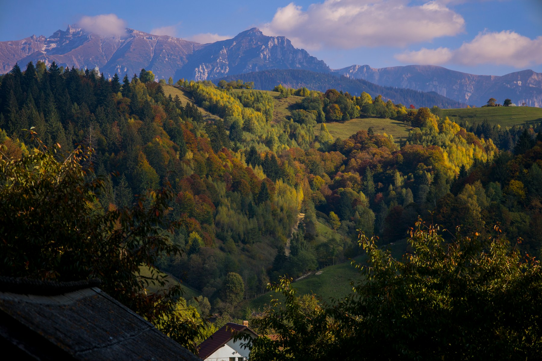
This is the stop that reorganises the whole idea, and it only became available in 2024. UNESCO records Frontiers of the Roman Empire – Dacia as extending more than a thousand kilometres along the western, northern and eastern borders of the province, running from the Danube at each end, taking in the Transylvanian Plateau and crossing the lowlands of Muntenia along the Olt River. It was part of the Roman frontiers for nearly 170 years.
Two things in that record are worth sitting with. The first is that Dacia was the only Roman province located entirely north of the Danube. Everywhere else, the river was the border; here Rome crossed it and drew a new one in the Carpathians. The second is the stated reason, which is not defensive at all: the record says the frontier secured access to valuable gold and salt.
It is also the longest single section on the list, at almost twice the length of the Upper German-Raetian Limes and roughly eight times Hadrian’s Wall. Its inscribed area, 1,491.6 hectares, is the largest of the four, and its buffer zone of 14,197.61 hectares is almost exactly as large as the other three buffer zones put together.
And there is a gap you can see from the register alone. The Danube entry is officially the Western Segment, and it stops at Iza in Slovakia. We checked the World Heritage lists of Hungary, Serbia, Croatia and Bulgaria and found no Roman frontier property on any of them. The eastern Danube limes is simply not inscribed, which makes Dacia the end of the line in practice as well as on paper.
Best for: travellers who have walked Hadrian’s Wall and want a frontier nobody they know has done.
Go when: late May to early October, on our judgment — Carpathian mountain roads are the constraint, not the sites.
7. The Dacian Fortresses of the Orastie Mountains — the Other Side
Inland from the Dacia frontier sits the kingdom it was built to contain, inscribed separately in 1999. UNESCO describes six defensive works built in the first centuries BC and AD under Dacian rule, the nucleus of the Dacian Kingdom, showing an unusual fusion of military and religious architecture from the classical world and the late European Iron Age. They were conquered by the Romans at the beginning of the second century AD.
The record gives no inscribed area for this property, which is a gap in the citation rather than a small site. Go here last and the frontier stops being Roman infrastructure and becomes a border between two peoples, one of whom lost.
Best for: closing the argument Hadrian’s Wall opens, rather than adding a sight.
Go when: June to September, on our judgment — several of the six sit at altitude on unsurfaced approaches.
More from Dorian Destinations
Best Places to Visit in Europe: Pick the Month, Then the Place
The Four Inscriptions, Side by Side
| Property | State parties | Stated length | Inscribed | Inscribed area |
|---|---|---|---|---|
| Frontiers of the Roman Empire — Hadrian’s Wall, the Antonine Wall, the Upper German-Raetian Limes | United Kingdom, Germany | 130 km (plus 36 km of coast), 60 km, 550 km | 1987, boundaries modified 2005 and 2008 | 526.9 ha |
| Frontiers of the Roman Empire — the Lower German Limes | Germany, Netherlands | 400 km | 2021 | 812.75 ha |
| Frontiers of the Roman Empire — the Danube Limes (Western Segment) | Germany, Austria, Slovakia | almost 600 km | 2021, minor boundary modifications 2024 and 2026 | 821.748 ha |
| Frontiers of the Roman Empire — Dacia | Romania | more than 1,000 km | 2024 | 1,491.6 ha |
| Dacian Fortresses of the Orastie Mountains | Romania | not a frontier property; six fortified sites | 1999 | not stated in the record we read |
Lengths, inscription years and areas are quoted from each property record on the World Heritage List; the wording of the lengths is theirs, which is why some are exact and some are approximate. The bottom row is included for context and is not part of the frontier family. Read the area column as what was inscribed, not as how much there is to see — these are long thin boundaries, and the Dacia buffer zone alone is nearly ten times its inscribed area.
How to Build a Hadrian’s Wall Trip That Keeps Going
None of what follows is in the property records. It is how we would actually route it, and it is judgment.
Take two sections, not six
Six sections across six countries is a month, and a month is not what most people have. Pair Hadrian’s Wall with exactly one continental section and the trip gets an argument instead of an itinerary. Hadrian’s Wall plus the Lower Rhine is the easy version; Hadrian’s Wall plus Dacia is the one nobody has done.
Let the rivers and the railways carry you
Two of the four inscriptions follow rivers, which means the transport already exists. The Rhine and Danube sections sit beside scheduled trains and scheduled boats, and a rail-first approach of the kind we use in Switzerland works just as well along the limes. Hire a car only for Dacia and the Orastie fortresses.
Ask any operator two questions
First: which inscribed sections does this itinerary actually enter, by name? Second: how many of the stops are reconstructions and how many are original fabric? The answer to the second question tells you far more about the company than the answer to the first, because anyone can read a list and very few will volunteer that the handsome fort gate is a modern reconstruction.
Have us build the frontier leg before you book the flights →
Frequently Asked Questions
Is Hadrian’s Wall a UNESCO World Heritage Site?
Not on its own. UNESCO inscribed it in 1987 as one of three sections of a property called Frontiers of the Roman Empire, alongside the Antonine Wall and the Upper German-Raetian Limes. The property boundaries were significantly modified in 2005 and again in 2008.
How long is Hadrian’s Wall?
The property record states 130 kilometres, from the mouth of the River Tyne in the east to the Solway Firth in the west, built on the orders of the Emperor Hadrian in AD 122. A further 36 kilometres of intervisible military installations continued down the Solway coast.
What else is part of the Frontiers of the Roman Empire?
Three more inscriptions: the Lower German Limes across Germany and the Netherlands and the Danube Limes (Western Segment) across Germany, Austria and Slovakia, both from 2021, and Dacia in Romania, added in 2024. Six state parties in total.
Can you walk the whole Roman frontier in Europe?
Not as one continuous marked route. Add the lengths UNESCO states for each section and the total is a little under 2,800 kilometres by our arithmetic, spread across six countries and four separate inscriptions. Beyond Hadrian’s Wall, long stretches are buried archaeology or lie under modern towns.
Which part of Hadrian’s Wall is best preserved?
The record is specific: about four fifths of the line runs through open country, and within the central 45 kilometres of its course the remains survive in an exceptionally good state, as part of a landscape that still carries visible traces of the Roman military presence.
The Dorian Destinations Verdict
Do not book the three-day Hadrian’s Wall break. It is the easiest thing in this category to sell, we are asked for it constantly, and it sends people home convinced they have seen a Roman frontier when they have seen under one twentieth of one.
Spend the same money differently. Hadrian’s Wall and one continental section, properly joined, is a better trip at the same price and a far better story. The register has been quietly assembling this thing since 1987 and finished its most recent piece in 2024; almost nobody has noticed.
That advice costs us money, because a long-haul client doing two countries books more hotel nights but also asks far more of us per booking than a weekend in Northumberland does. We would still rather you saw the frontier than the photograph of it.
Talk to a Dorian Destinations travel advisor →
Sources: UNESCO World Heritage Centre property records for Frontiers of the Roman Empire (430), the Lower German Limes (1631), the Danube Limes, Western Segment (1608), Dacia (1718) and the Dacian Fortresses of the Orastie Mountains (906), together with the World Heritage state-party listings for the United Kingdom, Germany, the Netherlands, Austria, Slovakia and Romania, checked 14 October 2026. UNESCO descriptive text is reproduced in quotation marks under CC-BY-SA IGO 3.0. Routing, pairings and all seasonal advice are our own judgment and are labelled as such on the page.
Cultural Travel · Europe · Adventure Travel · Luxury Travel